fbpx

The Grizzly vs. the Truck

Video of Bear Attacking Truck

One this size might have been grizzly proof

The grizzly stood erect at the back of the “small paneled Canadian truck” slapping it with is enormous paws, rocking it in every direction. Rounding a curve in his bigger truck, John Friese spotted the small truck parked by the side of the road, “shaking with movement in the back section.” It took him just a moment to spot the slap-happy grizzly causing the shaking.

Link to another bear story. “The Rude Bear”

If you look through the passenger window and see this…

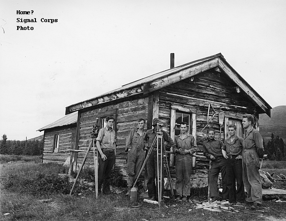
In 1943 civilian contractors continued to work on the Alaska Highway, straightening and upgrading. Pederson Brothers Construction Company had brought John Friese north, and that winter the eighteen year old had a list of jobs as long as his arm.

This particularly frigid morning found him delivering supplies to another Pederson camp twenty-five miles up the road. He drove slowly and with great care. The Highway, he knew, could deceive a driver—looking smooth, covered by snow and permafrost until it suddenly “dipped into a wide crevice where part of it had slid down the mountain.”

Rounding a curve he spotted the small truck stopped by the side of the road. It “shook with movement in the back section”.  It took a moment to see the grizzly, standing erect slapping the truck with its enormous paws.

The seven foot tall monster, “had already clawed through the rubber-covered wooden slats of the truck top.” And he had broken several windows.  The driver scrambled around inside in raw panic trying to avoid the bear’s huge, furiously groping claws.

Clearly not the truck in question but this is what a grizzly can do to a vehicle

John edged his bigger truck closer to the action and yelled to the driver to open a side window. The French/Canadian Driver didn’t understand English.

John pulled right up next to the smaller truck and rolled down his passenger side window. “The terrified forty-year old man tunneled through the window of his cab, and into my truck. Off we roared.”

John looked in the mirror once to see the grizzly continuing to demolish the truck.

Sleeping Standing on their Heads

The river adjacent to the Fort Nelson Airport

Sleeping standing on their heads? That’s just one of the things the Tomlinson men hadn’t anticipated when they headed north.

Link to another story “Ft. Nelson, Chester Russell’s Passage”

At the beginning of World War II, officials in Washington and Ottawa developed a propensity for dispatching men deep into the subarctic north to accomplish all but impossible missions. Canada had entered the war alongside Great Britain in 1939 and young Canadians had been fighting and dying all over the world for two years. That made Canada more sensitive to North America’s strategic vulnerability in Alaska. So Ottawa moved first; sent contractors like Tomlinson north to build a string of airfields that would allow planes to fly to Alaska.

A Canadian bush pilot and entrepreneur named Grant McConachie who ran a small airline that delivered mail between Edmonton and Whitehorse, used a series of spots on the map to stop and refuel—Fort St. John, Fort Nelson and Watson Lake. He struggled to clear airstrips at each stop.

In early 1941 the Canadian Government, named his series of airfields the Northwest Staging Route and took over the effort to build and improve them. Tomlinson Construction Company took on the facility at Fort Nelson.

Dog Teams got involved too

Tomlinson men and their equipment and supplies road the rails to Dawson Creek.  To get supplies and equipment, not to mention themselves, to Fort Nelson from there, Tomlinson put together a convoy of ten gigantic sleighs—five for freight and five for crew—to be towed five at a time by a D7 Caterpillar tractor.  D8 Cat’s would growl ahead along the old trail, gouging a path through the timber.

The Tomlinson men slept in a bunkhouse on a crew sleigh that more often than not rested on a steep mountainside, chained to a tree—leaving them to sleep standing on their heads.

The old trail north from Dawson Creek wound through heavily wooded mountains and across the Sikanni Chief River.  The D7 would tow five sleighs up to the advancing trailhead then go back for five more.  Progress through the frozen landscape was slow and incredibly difficult—but steady—until they reached Sikanni “Hill”—a steep drop down to the banks of the Sikanni Chief River.  That last mile to the river took three agonizing days.

And then there was the river itself. It was still frozen, thank God, so the D7 and its cargo could make their way across.  But the ice was rotten and fifty feet from the west bank, the tractor plunged through the ice to the bottom.  The crew spent three more days rigging a makeshift tripod of logs and cables to lift the tractor and get it to land where it could be dried out under a makeshift canopy and returned to service.

Tractor on snow and ice

It took four months to get to Fort Nelson.

More on the Northwest Staging Route


Mushy Spring Ice and Bush Pilot Bob Reeve


The famous pilot and his plane

Mushy spring ice doth not a runway make. Famous Alaska bush pilot Bob Reeve found that out at Burwash. Willis and the surveyors were there.

Link to another story “Stench and Reeve Airways”

The Army occasionally hired Reeve to ferry personnel from place to place along the route of the Highway, and about two weeks after Willis and the surveyors arrived at Burwash, Reeve flew in with a party of Engineers.

Burwash had an airfield. But it lay a mile from the post and Reeve didn’t feel like walking. Burwash also had frozen Kluane Lake, and Reeve found it much more convenient. He glided out of the sky aimed at two rows of felled trees laid out to mark a landing strip on the ice, touched down and rolled to a stop. All OK.

Adding fuel

But then he turned the plane toward the shore. The “honeycombed and mushy late spring ice… started to yield beneath his wheels.” He quickly killed the engine just as the left wheel broke through. A second later the other wheel joined it and the belly of Reeve’s plane lay flat on the ice.

Over night the lake ice froze hard again and in the morning, the surveyors launched a rescue operation. Timbers under the engine would prevent further settling. But lifting the plane high enough to free the wheels required ingenuity.

They constructed tripods and hung chain blocks over the plane. Strong enough to hold the plane in the air, the chain blocks couldn’t lift it, so they lifted it with jacks placed under the plane. Lift then chain, then move the jacks and lift and chain… Finally the wheels emerged from the ice. Bob took off and the surveyors returned to surveying.

On the glacier

Years later Bob Reeve told his biographer about the incident.  He blamed the softened ice on the hundred or so construction workers walking and weighting it. Willis points out, “that in May 1942 construction had not yet started and the Army wasn’t within a hundred miles of Burwash Landing.”

More on Bob Reeve

Burwash Bounce

Willis and his crew at home.

Burwash Bounce didn’t mean a thing to the Army, but it meant everything to Willis and his fourteen fellow surveyors.

Link to Part 1 “Willis Grafe, Civilian Roadbuilder”

Needing surveyors for the Alaska Highway Project, the Army blithely ignored the fact that most of Willis’s group of fifteen had exactly zero experience as surveyors. In early 1942 an airplane dropped them at Burwash Landing at the north end of Kluane Lake. Apparently Burwash would provide the adventure that had attracted Willis and the young member of the crew to Yukon. and the very next morning they headed out to survey. Burwash Landing at the north end of Kluane Lake would provide the adventure that attracted Willis and his fellows to Yukon.

The day after they arrived they trudged up the lakeshore against a cold wind for about two hours until Chief Fred told them to stop. “This is where we start.” Fred drove a short stick into the ground, and “at last,” Willis remembered, “I was beginning to learn about surveying, the first lesson being that a hub is not always the middle of a wheel but may be a stick in the ground with a tack in it.”

Real surveyors

It didn’t take Willis long to figure out that most of his surveying would consist of swinging an axe to clear trees and brush out of the way of the few real surveyors.  They walked and surveyed and cleared brush, activities that didn’t leave a lot of leisure time. For that matter they didn’t leave a lot of energy for leisure activity.

That’s where the Burwash Bounce came in.

Saturday night became sacred. The Burwash camp housed, in addition to the surveyors, some Pan Am radio operators who had a gramophone. More important, the Burwash camp employed Babe, Belle and Ada to run the dining room.

Dance in the 40’s

The gramophone

“The dining room, about 12 by 24 feet, would be cleared for action, and the linoleum floor swept clean.” And the Burwash Bounce commenced.

They would dance until 1:00 or 2:00 am or until the three badly outnumbered ladies gave up in exhaustion.

One Night

The ride up the mountain

One night, that is all Willis Grafe and his friends got as the guests of gracious Harriett Pullen. Willis had signed on to help the Army build the Alaska Highway and in early 1942 the Army intended to get him to where they needed him as quickly (and as cheaply) as possible.

From the Pullen House they put him on the WP&YR railroad, and four steam engines powered the train up into the Canadian mountans. At the top, at Lake Bennet, they released three engines. One “puffer” would do for the rest of the ride. And before they left Bennett the Army fed them—apple pie, cheese and sweet pickles.

Link to Another Story “The Steepest Railroad Grade”

Late afternoon found them in Whitehorse and this time someone had booked hotels. They actually stayed for a few days, filling in as freight handlers—getting supplies off the train and onto steamboats.

Willis’s accommodation in Whitehorse

Willis knew nothing of surveying, but the Army figured he could learn on the job so they assigned him to a survey crew. With fourteen other men, Willis would survey the portion of the route headed north from Burwash Landing, about 200 miles north of Whitehorse at the north end of Kluane Lake.

Three or four of the crew had experience. “And then there were the rest, all prepared with enthusiasm and good health to offer.”

They couldn’t all head for Burwash Landing at once, “the old Curtis Condore biplane… had a limited capacity’. But eventually Willis’ group made it into the air.  “The coastal mountains on [their] left loomed white and mysterious clear to the horizon.”

Burwash Landing at the end of the Lake

Two hours and 150 miles later they touched down on the four feet of ice that covered Kluane Lake. And from the lake they “struggled their way” to their assigned quarters—in Willis’ case a one room cabin for six they called the “Boar’s Nest.”

Burwash Landing Today

Willis Grafe, Civilian Roadbuilder

Port of Embarkation–the adventure begins

Willis Grafe, in early 1942, had a job he didn’t like in Salem, Oregon. And he heard a rumor. The United States Public Roads Administration wanted to hire surveyors to send north to Canada and Alaska to help the Army build a Highway.

Link to another story “Civilians on the Alaska Highway Project”

In his memoir, An Oregon Boy in the Yukon, he remembers it this way. “I was hired on the spot.” In two days he found himself in Seattle Processing through the port of embarkation. “Processing consisted primarily of marching in a line between two medical corpsmen who hit us with a needle in both arms at the same time.”

Punctured and punctuated, the men made their way to an old wooden steamer where the Quartermaster Corps issued tickets for “HOLD #1”. Nine or ten feet down a ladder they found themselves in “Hold #1”, a “gloomy room… with row after row of steel pipe bunk stations, three tiers high.”

At least for Willis they were only 3 high

Averaging seven knots the ship made its way up the inside passage. From the deck the men saw that they followed “a narrow waterway between wooded islands”. The trip featured open air dining, and Willis found that large coils of hawser made satisfactory tables.

A few days later as they approached Skagway, the shore of the channel became “more and more impressive as the mountains got higher”.  And the weather got colder and wetter. Worse, nobody had made provisions for housing in Skagway.

Broadway St. Skagway 1942
Signal Corps Photo

Because Willis and four of his friends could walk faster than most, they beat the crowd to Harriet Pullen’s Pullen House. A fixture in the Skagway community since Gold Rush days.

The boys couldn’t afford restaurant food so they bought groceries and took them back to the hotel, planning to prepare and eat the food in their rooms. A most gracious hostess, Harriet would have none of that. She invited them to come use her kitchen and fill her in on all the “frantic activity going on around us.”

More on Ma Pullen

We will come back to Willis.

Flying Over

Smooth

Flying over the subarctic north? To those who endured difficult, dangerous, and often just plain miserable trips on the ground through that beautiful but hostile country, airplanes offered an attractive alternative. But, of course, mother nature in this part of the world makes nothing easy, including flying over it.

Link to another story “Becoming a Bush Pilot”

World War I made airplanes and flying serious business. And after the war a few Army pilots wanted to keep flying, but the Army didn’t need them. More, the Army didn’t need the planes they flew; made them available cheap. Inevitably some of these pilots and planes made their way to the North Country, offering a new possibility for travel and transport—flying over it instead of trudging through it.


Like everybody and everything that had ever found its way to this beautiful but brutal world, air transport developed an utterly unique form.  Pilots who flew over British Columbia, Yukon and Alaska quickly learned that techniques they learned elsewhere were useless.  Those who survived became not just pilots, but “bush pilots”—pilots with a unique skill set.

So who is tied to what?

Reading a compass gets tricky close to the North Pole. Because of the vast distances and magnetic and atmospheric interference radio works sporadically if at all. When, in blissful ignorance, the US Army Air Corps sent mere pilots north via the Northwest Staging Route in 1942, the results proved famously disastrous precisely because the pilots didn’t know how to navigate and, worse, because they didn’t know they didn’t know.

Bush Pilots flew by dead reckoning over terrain they had memorized over long experience.  If cloud cover made it impossible to see the ground, they “pruned the treetops”, scouring what they could see for a familiar mountain, lake, or stream.

A plane designed for speed,

They had to be masters of the ground as well as of the air.

A pilot suffering mechanical problems and needing to get his plane on the ground had few options. Usually he found a remote lake. And if he made it to the ground, he rarely enjoyed the luxury of communicating his plight to anybody who might be able to help himThat meant he had better be a mechanic as well as a pilot. Finally, when repairs proved impossible he needed to survive in the rugged wilderness and navigate his way back to civilization.

Becoming a Bush Pilot Today


Equal Opportunity Torture

Equal Opportunity torture–no racism here.

Equal opportunity torture. The subarctic north offered cold and mud and cliffs to anybody who challenged it. And, as the black soldiers of the Corps would learn when they came in 1942, the mosquitoes and the no see ums landed and feasted on skin, utterly indifferent to whether it was black skin or white.

Link to another story “Horse and Mosquito”

Bureaucrats argued over the route, but they wasted their breath. The only possible path had come down to the Corps from prehistory. And if the soldiers had no idea what awaited them, the people scattered along the 1500-mile path certainly had no idea what was about to descend upon them.

The land of the Midnight Sun could offer a traveler the spectacle of a golden lavender sunset in the west and a rising moon, dusted with the same hue in the east.  Oversized and spectacular, the land dwarfed every living thing in it—mosquitoes, moose, grizzlies and, very occasionally, men.

Winters surrounded everything in this country with temperatures that could freeze coffee between the pot and the cup.  In spring red-purple fireweed blanketed the ground and, as the top layers of permafrost melted, stately spruce trees slowly leaned. Ice and snow melted into roaring rivers that scoured mountains down into flats and spread them in great alluvial fans of gravel and dirt.  Water melted into the dirt and formed mud and more mud and, like lava, slowly swallowed random logs.

Primordial trails and water routes gradually, fitfully improved from prehistoric times through the Gold Rush and on through the first 40 years of the 20th Century. Struggling to make improvements, the men of The North Country accumulated knowledge and experience the men of the Corps would learn, sometimes the hard way, to depend on.

In 1930, The Northern Alberta Railroad extended its tracks from Edmonton to Dawson Creek. From there a relatively easy 46 miles took a traveler to Fort St. John—and the mountains, over 300 miles of mountains, each bigger than the last. The rugged path from Fort St. John through Ft. Nelson to Watson Lake and the Liard River Country had changed little from the days of the primordial First Nations. For that matter, north of Watson Lake the country remained Tlingit country. The only thing resembling a town in this portion of the route was the tiny Tlingit village of Teslin between Teslin Lake and Nisutlin Bay.

On north lay the only city in Yukon. Whitehorse housed about 4,800 souls. And the railroad built to carry long gone gold rushers, the WP&YR, survived, carrying passengers and freight up from Skagway.


A small gold strike near the northern end of Kluane Lake inspired the territorial government to build a primitive road over the 150 miles from Whitehorse to Kluane in 1904.

The Railroad bequeathed by the Gold Rush

North from Kluane, at the border between the United States and Canada, an Athabascan seasonal hunting camp had morphed into the tiny settlement of Northway. And further north lay another hunting camp, Delta. Since an existing road connected Delta to Fairbanks, the Alaska Highway would end at Delta.

Delta Junction Today

As the Crow Flies

Where the crow would have flown…

As the crow flies, Lake Bennett lay just a few miles from Skagway. Theoretically Klondike gold rushers could travel those few miles from the Skagway dock to Lake Bennett, build or buy a boat and cruise down Lake Bennett to Carcross and the Yukon River. The Yukon could then float them downstream all the way to Dawson City and the Klondike.

Unfortunately, it did not work like that.

Link to another story about another route “Glacier, the Valdez Glacier”

First of all, the Klondike Gold Rushers were not crows, so as the crow flies didn’t apply. The few miles to Lake Bennett climbed from sea level to the top of the Coastal Mountain Range, thousands of rugged feet almost straight up. And the rushers had to traverse it on foot, carrying packs.

Second, those who made it to Lake Bennett and acquired a boat, faced 548 difficult miles of Yukon River. And the Yukon immediately confronted them with the Whitehorse Rapids. By June of 1897, the rapids had already claimed 200 boats.

Finally, the river offered passage only after the Yukon ice broke up in the spring and only until the ice reformed in the fall.

Waiting for word that the ice was gone

In early May of 1898 a motley flotilla of seven thousand boats and rafts lay poised at Lake Bennett.  Builders were working frantically on as many as a thousand more at Lake Lindeman and Caribou Crossing.  The boat builders stripped every bit of forest they could reach.

On May 29th, word reached the would-be miners that the ice down river had broken.  An incredible flotilla–canoes, scows, rafts and barges–burst like race horses from the gates out into Lake Bennett, surging toward the narrows at Carcross.  Attrition, of course, began immediately. Many of the vessels in the ragtag flotilla fell apart before they even got across Tagish Lake.

Whitehorse Rapids

In the end those who actually made it down the Yukon to Lake Lebarge and through the final leg to the crowded docks at Dawson City were a lucky minority.  The path from Lake Bennett was littered with the detritus of those who tried and failed.

Gold Rush National Park at Lake Bennett

Like generations of historical predecessors who found themselves travelling through the subarctic north, the Klondike Gold Rushers ran smack into how very difficult travelling there could be. And, like their predecessors, they wound up using and improving prehistoric paths. The improvements formed important parts of the reality the Corps would confront in 1942.

Nature, Dictator not ‘Mother’

One of many Yukon mountains

Nature, a dictator, not a ‘mother’, rules the rugged, remote, austere, breathtakingly beautiful, and viciously inhospitable subarctic north. In 1942 the Corps of Engineers had no choice. A land route to Alaska, an Alaska Highway, would have to span this portion of nature’s turf.

Link to another story “The Only Possible Route”

To this day the region is a vast expanse of raw wilderness with virtually no population.  Alaska, alone, encompasses 663,267 square miles.  In 2013 its population was only 735,132.  Prior to the war boom, its population was 73,000.  Moose outnumber people and probably always will. And most of the Highway would span British Columbia and Yukon Territory, even more raw and unsettled than Alaska.

A George through a piece of Yukon

Men had come to, confronted dictator nature, and lived in these regions long before the corps.  And their lives and works had shaped the environment the Corps would face in 1942.  Scattered along the length of the proposed highway, their numbers were few.  But the tiny and tenuous bits of civilization they had created were an important part of the environment that awaited the Corps.

The first human inhabitants of the North Country were the people American’s call Indians and Canadian’s call First Nations.  They survived for thousands of years in the harsh environment by treading lightly on the land—accepting at the very core of their culture and way of life the absolute dominion of nature.  For the Indians, man, like every other living organism, is a guest in the North Country, not a conqueror.

The first white men to come to the North Country were attracted by the exquisite pelts of the native animals.  Russian traders made their way from Western Siberia across the Bering Sea to Sitka, Alaska and points south along the Alaska Panhandle to the periphery of British Columbia.

The North West Company sent traders into Yukon Territory.  They established trading posts through British Columbia and on into Yukon Territory.

The trading posts and the traders offered opportunity to the First Nations.  The implements and tools—everything from pots and pans to rifles – that their furs could purchase at the trading posts became part of their life and culture and changed both in the process.

One of the endless rivers

If the trails between the posts had evolved from those established by their native forbearers’ migratory patterns, those trails, in turn, tended to change the patterns.  Getting to the posts to trade became as important as getting to the right place for hunting and fishing.

All of this evolved long before the US Army even thought about building a road through the region, but when they invaded in 1942 they would follow the path handed down through history by the region’s people.

Yukon History