fbpx

Blazing the Path of the Alcan

They worked from here, but they didn’t get to stay here much.

Blazing the 1800-mile path of the Alaska Highway, soldier topographers led the way into the subarctic wilds of Northern Canada and Alaska in 1942. The first road builders rushed into frigid British Columbia in March. The soldiers of the 29th and the 648th Topographic Battalions had come in February.

Instead of maps, the topographers had aerial photographs, and sometimes they didn’t even have those. They looked for local guides who could help. Johnny Johns in Yukon, an unnamed “native” in British Columbia and many, many others helped with trail blazing.

Pvt Russel and His Fellow Soldiers Didn’t Come Alone

A survey party, one officer and nine soldiers, headed into the woods, scouting a route with potential. Another team came behind them, running a quick survey and taping trees. Finally, a transit team following the tapes, finished the trail blazing by recording the centerline and elevations for the road builders headed their way.

A survey team coping with snow.

Pack mules hauled their supplies and equipment and they pitched tents and bedded down wherever they could. They ate what they could carry on the mules and what they could shoot in the woods.

The work could be pleasant

The path through the Canadian Rockies offered the toughest challenge. A local named McCusker had gouged out a rough trail many years earlier—a very rough trail. They could follow him. Or they could follow him for the first forty miles or so and then branch off to follow the Liard River and avoid at least some of the mountains.

But the branch along the Liard ran over the bane of the Alcan Project—decaying vegetation, swampy, frozen to solid ground in winter but boggy muck from spring to fall. The branch ran over muskeg.

Maybe McCusker had known what he was doing?

The soldier topographers followed McCusker.

Hiking Trails in British Columbia Today


Liquified Soil

After crunching, sinking into the ocean and being inundated by a 200 foot tsunami

Liquified soil? Tectonic plates? On Good Friday afternoon people in Valdez, Alaska didn’t think about such things, few even knew they existed. People in Valdez thought about dinner. Then came a crunching and a grinding noise and the ground around and under them suddenly rolled and heaved. Great cracks appeared and water spurted up through them.

Valdez Offered a Point of Entry for the Alaska HIghway Builders

Valdez had sprung into being 64 years earlier when gold rushers flooded north through the North Atlantic and Prince William Sound to try their luck at the “All American Route” to the Klondike. The land portion of the route started with a climb up the Valdez Glacier, and Valdez sprouted between the glacier and the harbor. It sprouted on sand and gravel.

Old Valdez before the plates collided

In 1964 the giant Pacific plate tired after eons of butting heads with the equally gigantic North American Plate, suddenly shoved itself 30 to 60 feet up under its neighbor. People and property suffered consequences as far away as Washington, Oregon and California.

Fifty-six miles from the epicenter, the crunching and grinding and the rolling and heaving lasted until the sand and gravel—the earth—under Valdez turned to liquid and much of the town simply sank into the water.

When the ocean itself reacted and sent a 200-foot-high tsunami toward the shore, it swept over and destroyed the rest of Valdez.

Being Alaskans, the survivors would remain in Valdez, prepared to survive more earthquakes and tsunamis. They would not again deal with liquified soil. They rebuilt their town, but they moved it a few miles up the coast away from the sand and gravel.

Old Valdez looks like this today

More on the Massive Alaska Earthquake

Blues and the Highway Project

On the platform at the Carcross Depot

Blues came to Yukon in the blood and marrow of soldiers from the Mississippi Delta—the soldiers of the 93rd Engineering Regiment. After all, the blues were born in the Delta too. On a wall in the Carcross Depot today hangs a photo of a large group of black soldiers in front of the 1942 depot. Many of the men hold musical instruments.

Carcross–North Country Gateway

From a wall on today’s depot

Lt. Mortimer Squires who served as regimental motor officer in 1942, remembered the soldiers spontaneously breaking into song—sometimes forming into quartets or breaking out a guitar or harmonica.

And Millie Jones remembered the men and their music.

Ten-year-old Millie had spent her life in Carcross—Mom cooked at the hotel, Dad and Grandpa worked for the railroad. Soldiers had ridden the trains through town on their way to Whitehorse for weeks, but one day the train stopped and began disgorging soldiers. Millie ran, bursting with excitement, to the depot with her schoolmates to see the “black white men”.

The army wouldn’t allow the black men inside the hotel. They couldn’t even come to the front door. But they came to the back door to request drinking water. And Millie’s mother supplemented that refreshment with fresh baked bread. Sometimes with cookies.

Helping to clear the dining room one evening, carrying a stack of dishes to the kitchen, Mille heard the most incredible sound she’d ever heard coming from the back porch. She aimed the stack of dishes at the table; missed; didn’t even notice.

Someone had rolled the piano out to the porch where a black soldier brought sounds out of it that Millie had never heard before.  And other soldiers gathered around with other instruments—guitar, trumpet, banjo…

In her living room in Whitehorse, seventy years after the fact, Millie’s face shines at this memory from her girlhood.  Asked, somewhat hesitantly, whether she remembered the name of the tune, she flashes a broad grin and, without hesitation, says “Pistol Packing Mama”.

More on the song Pistol Packin’ Mama


Russell Wesley on the WP&YR

Up from Skagway, emerging from a tunnel

Russell Wesley’s comment popped up on my post about the White Pass and Yukon Railway the other night, and it took my breath away. Russell got my attention with this, “When I worked on the Yukon and White Pass Railway in the early 70’s, we had no modern equipment. We had a radio that was hooked to the wire by use of a long pole and then could contact a train stopped and their radio hooked up in the same manner. Reminiscent of the phone in the pole in the tv show Green Acres.”

The Steepest Railroad Grade–The Post That Got the Comment

He continued, “We had no modern anything except a motor in our speeder. Everything we did was with tools from the days the railway was built. I felt so honored to be following in their footsteps.”

The middle car carries tools

I responded, of course, and Russell commented again. “I remember riding on the speeder as we went out from camp to do our daily work on the rails. I am so glad that I had the experience I had with my job on this most historic railway. Our feet would be hanging from the speeder as we looked down 300 to 500 meters down. Ties often overhung the rail bed.”

Next train out

When I answered that, Russell came back with this. “One day when I was in Lake Bennett, I went into the old church still standing. I stood at the lectern and gazed out to where the lay people filled the pews. Stilling my mind, and I felt the spirits of those who were here. A shiver went through me. An experience I will never forget.”

I shivered with him as I read that, and I told him so.  He answered, “I told the story well then. And I am happy you got that shiver. Yukon, a place you do not go to see but to experience. Words cannot do justice to Yukon. Though Robert Service sure did a good job at it.”

Thank you, Russell.

More on the incredible little railroad


Tagish River

A D8 Dozer loads a heavy trailer on the pontoon men’s “bridge”

Tagish River, 1,275 feet wide, posed the first major obstacle to the 93rd Engineering Regiment. To build Alaska Highway through Yukon, the soldiers of the 93rd had to get a road out of Carcross, and during the first week of May local guide, Johnny Johns, guided Captain James Cassano as he laid out a path for one. At the end of the week, 23 miles out, they reached the Tagish river with Tagish Village on its far side.

The Steepest Railroad Grade–getting to Carcross

The soldiers of the 93rd came to build road. The soldiers of the 73rd Pontoon Company would deal with the river.

On the wintry early morning of May 6, half of the regiment’s soldiers, three companies, swung their axes and dropped their dozer blades, digging into Cassano’s path out of Carcross. They worked past Lake Jacoby and then Crag Lake relatively easily. And the soldiers of the 73rd Pontoon Company struggled through the woods right behind them, dragging their ferry.

When the road builders reached the Tagish, the soldiers of the 73rd reached it with them and they immediately set about creating their temporary ‘bridge’.

The “barge” stayed in place for awhile

The pontoon men attached their fourteen-foot-wide by forty foot long platform to the top of five 4 foot by 24 foot pontoons.  On each of the two outermost pontoons they mounted a twenty-horsepower outboard motor.  To the center pontoon they attached a larger motor for emergency use.

The road builders of Company A reached Tagish River at 7 pm on the 28th. and it took two days to get them across to the village. Company C crossed on the 30th.  B Company crossed on June 1.

The first goal, Tagish Village

The ferry could carry one D8, or two large trucks or four weapons carriers.  It could also haul a large crane-shovel—minus its boom. And the ferry would remain in place, carrying a flood of supplies and heavy equipment across until the road builders could get back and build an actual bridge.

Tagish and the River today


SS Chirikof Carried the Real Deal

On Adak

SS Chirikof carried the soldiers of the 93rd Engineering Regiment from the Alaska Highway Project to their second front in WWII, islands in the remote Aleutians. “The 93rd would do the necessary but unglamorous work of building and maintaining runways, hangers, barracks and other facilities for Alaska Defense Forces in the Aleutians until the middle of 1944.” (from our book We Fought the Road)

In early 1942 General Simon Bolivar Buckner, commander of American forces in Alaska, had contemptuously dismissed the idea of black soldiers, let alone black engineers. But the black soldiers of the 93rd had performed, and Buckner’s command dispatched them directly from the Highway project to the critical engineering job in the Aleutians.

Buckner’s command and SS Chirikoff did the soldiers no favor. The Aleutians “made Yukon Territory look like the Riviera. In addition to wild temperature variations, the Aleutians offered freakish winds—sixty or even 120 miles an hour—constant thick fog and endless rain and snow.” (We Fought the Road)

This was the “first draft” of an airstrip

In June 1942, the Japanese had horrified Americans by bombing the United States Naval base at Dutch Harbor and occupying Kiska and Attu at the far end of the Aleutian chain—American territory.

The Aleutians were as hard on trucks as they were on men

Few Americans Worried about the Aleutians

From hurriedly constructed airfields on the island of Adak, Army Air Corps bombers pounded the Japanese garrisons. The Corps of Engineers, continuously improving and adding runways, allowed the bombers and their fighter escorts to escalate their blitz.

In 1943 American and Canadian forces invaded and expelled the Japanese from the Aleutians forever. The Corps, and the soldiers of the 93rd, continued to maintain the facilities on Adak through 1944.

SS Chirikof had delivered the real deal.

Airplanes needed fuel

More on Adak


The Steepest Railroad Grade

They wouldn’t move without thawing and digging out

The steepest railroad grade in the world, the White Pass and Yukon Railway (WP&YR), carried men, supplies, and equipment for building the Alaska Highway up into Yukon Territory in 1942. From sea level at the Skagway dock the rails climbed 2,900 feet in just 19 miles.

Whitehorse Yukon 1942

The Saturday Evening Post in its November 27, 1943 issue featured an article called “Highballing It At 60 Below”. Captain Richard L. Neuberger wrote that the “old-timers and sourdoughs” had tried to warn the soldiers…”

Highly experienced, the soldiers of the 770th Railway Battalion thought they had seen everything. But “…with the thermometer on the station platform at Whitehorse registering sixty-eight degrees below zero and the snow piled forty feet deep on the uplands at Fraser Loop,” they learned different.

On the steepest grade, straight up out of Skagway, “The lead engine of a train is frequently thirty feet higher on the mountain wall than the caboose. Curves are so sharp that trains rounding them are curled up like a cowpuncher’s lariat. Overhanging precipices frown down on the thirty-six-inch tracks, and below the ties the cliff falls away 1200 sheer feet to the turbulent waters of the Skagway River.”

Stop a steam locomotive to take on water and its wheels freeze to the rails. When that happened, they called another locomotive up to “give the train a shattering bump.” In the Skagway yards, crews moved locomotives every ten minutes. “Drifting, wind-blown snow plugged the line at innumerable points.”

During the worst storm of the winter, “The mercury plummeted out of sight… Couplings that were wet had to be separated with acetylene torches. Metal became brittle and drawbars snapped under the loads. Fire doors in snorting, straining locomotives were coated with half an inch of frost. Exhaust steam pouring back into engine cabs froze the overalls of the G.I. crews as stiff as planks.”

History of the WP&YR

They couldn’t get rid of the snow. They just held it at bay.

Past the top of the grade the locomotives quit one after another. “When 81 and 62 at last succumbed to the blizzard, Colonel Wilson and twenty-two of his GI railroaders found themselves marooned. They took refuge in a tiny cabin near the line…”

From Carcross a D-4 cat bucked high winds across the frozen surface of Lake Bennett, ascended the pass and got through to the cabin with a load of food. ‘That bulldozer,’ said Wilson, ‘looked to us like six regiments with colors flying.’


Stench and Reeve Airways

Reeve’s and a friend who didn’t mind the stench.

Stench? Bush Pilot Bob Reeve’s ingenious innovations made him a legend. They also made him and his planes stink. “Reeve had worked out a way that he could pee past the stick and out a hole in the floor. The whole damned plane smelled of dried piss.” (A former passenger quoted in Alaska’s Skyboys by Katherine Johnson Ringsmuth)

Mushers fought Bush Pilots–more on Bob Reeve

But stench be damned, Reeve Airways needed Bob’s mechanical ingenuity.

Reeve made most of his money flying supplies to mines scattered throughout the rugged coastal mountains of Southern Alaska, and the mines offered only the most rudimentary landing strips—dangerous and hard on equipment.

To Reeve, the glaciers adjacent to nearly every one of the mines looked like potentially better landing strips, and snow remains on a glacier year around. He replaced the wheels on his plane with wooden skis.

On the Columbia Glacier

Of course, to land on the glacier ice, unpredictable and split by deep crevasses, he had to be able to see it clearly, and he found that swooping down onto flat, featureless ice he had virtually no depth perception. He learned to fly over the ice surface before attempting to land, dropping tree branches and burlap bags dyed black to bring the ice into focus.

Come spring, Reeve ran into a bigger problem. The supplies he flew to the mines came from the harbor in Valdez. If the ice on the glaciers at the mines remained year around, the ice in Valdez did not. He could land on skis at the mine, but he couldn’t take off on skis from the Valdez airstrip.

He built a special pair of stainless-steel skis and moved from the airstrip to the mud flats that fronted Valdez at low tide. Unlike snow, mud sucked hard on the skis, but he could rock the plane violently back and forth and break the suction.

Reeves in the mud–not hip deep

Working around his plane hip deep in mud impregnated with rotting seaweed and decaying salmon, Reeve stunk of more than just pee. And that stench made it into his plane too.

Bob Reeve Photos from Project Jukebox

Point of Entry

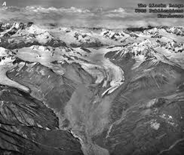
The Alaska Range–Some point of Entry

Point of Entry?  The North Pacific, the Bering Sea and the Arctic Ocean surround the unimaginably vast and forbidding territory of Alaska on three sides. The equally vast and forbidding wilderness of Northern Canada borders it to the east. For outsiders, Alaska offered no real point of entry before the turn of the century.

Until the turn of the century that didn’t matter much because Alaska offered little to draw outsiders. Then Skookum Jim and his crew discovered gold in the Klondike: and, quite suddenly a point of entry became a very big deal.

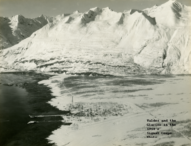
On one of the very few routes to the Klondike, gold seekers came by ship up the inside passage, climbed off the ship onto the mud flats at the port of Valdez. From the mud flats they confronted the towering Chugach Mountains–and the Valdez Glacier. The base of the glacier, folded by time and erosion, climbed abruptly between two enormous peaks separated by a deep cut.

Valdez and the Chugach from a 1940’s Photo

The first prospectors loaded themselves and their sleds and pack animals and climbed up the gigantic glacier into the interior, and a lot of them died in the attempt. The glacier featured enormous accumulations of snow, as enormous as any in the world. Deep crevasses and avalanches swallowed and smothered men and women and animals passing through it.

More on the Glacier

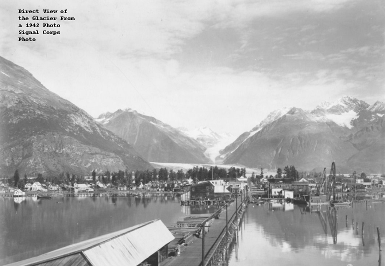
This shot, taken in 1942, shows a direct view of the slot up the glacier.

Another Route–Yukon River Route

But the Klondike offered gold, and by hook or by crook miners came up over the glacier and on to to the Klondike, trailing suppliers, gamblers, hookers and thieves. The Royal Canadian Mounties came to keep order on their side of the border. The United States Army came to do the same on the Alaska side.


“My uncle, Chester Russell, worked on the Highway.”

A day’s work at the Raspberry River

“My uncle”?!

Jim Price’s comment on one of my blogs a couple of years ago grabbed my attention. Chester Russel, an icon for historians of the Alaska Highway, had turned up repeatedly in our research for our book, We Fought the Road. We Fought the Road on Amazon

The Most Colorful Soldier

Occasionally they found a way to get clean clothes

In early 1942 The United States, suddenly at war with the Empire of Japan, its Alaska outpost in dire danger, needed a land route from the railhead at Dawson Creek, British Columbia to Alaska through some of the most rugged wilderness in North America. When the 35th Engineers rushed north to British Columbia to start building it, “my uncle”, a young ex-rodeo rider named Chester Russel rushed with them.

In 1999 a much older and wiser “my uncle” published Tales of a Catskinner to share his memories.

Chester’s Book on Amazon

I messaged Jim with my contact information, and the next day he called me to talk about “Uncle Chet.” Chester and the 35th went from the Highway Project to the European Theater and after the War civilian Chester took up farming for a while and then became a commercial fisherman in Oregon.

In his seventies Uncle Chet retired from fishing and in Tales of a Catskinner documented the memories of a private soldier on the Highway Project. He described the long march from the railhead at Dawson Creek across the rotting ice of the Peace River and on up the winding winter trail to Fort Nelson. Recalling that the trail behind them disappeared with the spring thaw, he remembered that if they hadn’t brought it with them, they wouldn’t get it for a while. The men got by on rations barely fit to eat.

Private Russell learned to operate a bulldozer. He learned that young lieutenants often need, in addition to formal Army training, serious training from their enlisted subordinates. He remembered an episode of bit and brace brain surgery. And he remembered that nearly all the soldiers in the regiment came down with what he called yellow jaundice.

Timber culverts got complicated

Ninety-eight years old in 2018, Chet still lived in Coos Bay, Oregon.